AI Property Boundary Generator for Listings
Turn a marked-up satellite image or site photo into a clear property boundary map with measurements — no CAD or GIS software required.
What it does
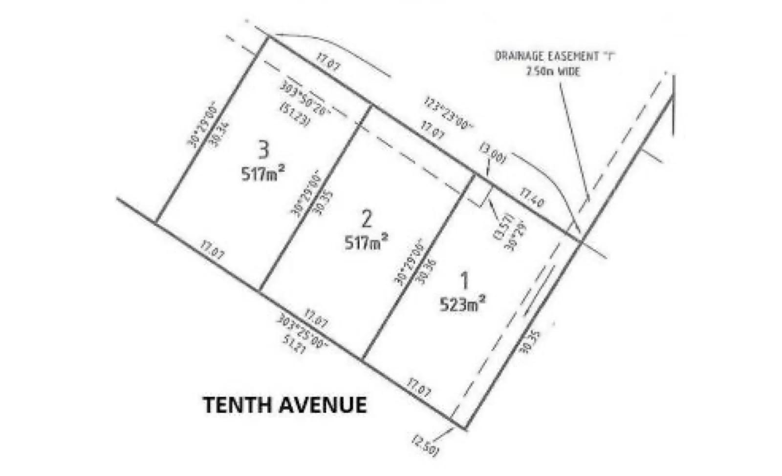
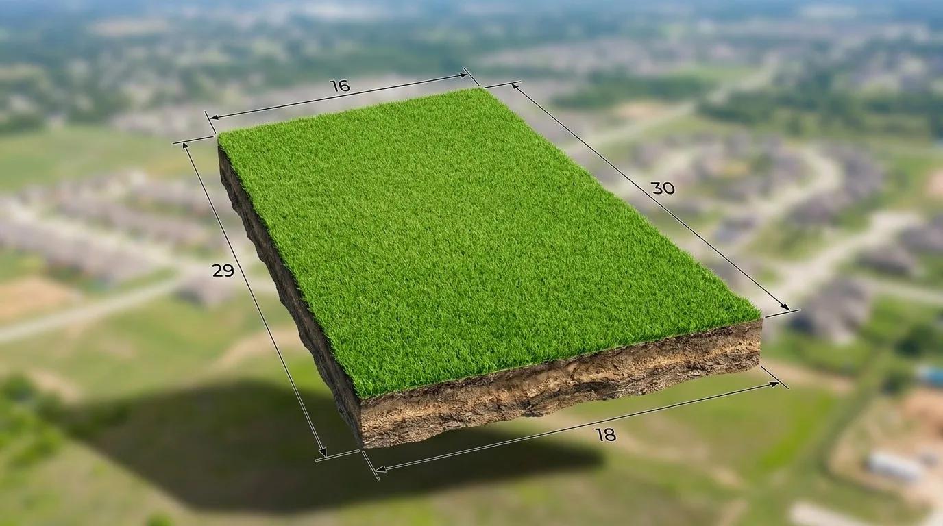
The Property Boundary Generator turns a marked up satellite view, site photo, or simple sketch with the boundary already marked on it into a clean, easy-to-read property boundary map. It traces the lot lines you’ve indicated and adds boundary measurements, so buyers can see the shape and extent of the land at a glance. The output is a marketing-ready site map for listings, brochures, and portals — created in seconds, without CAD, GIS, or drafting skills. It’s built to communicate a property’s layout clearly, not to replace a licensed land survey.
For the tool to draw an accurate outline, the boundary needs to be visible on the image you upload — a satellite or aerial image with the property lines marked on it, a plat or survey scan that already shows the parcel edges, or a sketch with the outline drawn in. The clearer the marked boundary, the cleaner and more accurate the finished map.
In one line: The Property Boundary Generator creates a clear property boundary map with measurements from a marked-up satellite image or photo — for real estate marketing, not legal use.
Who it’s for
- Real estate agents who want to show buyers the lot shape and size directly on the listing, especially for land, acreage, and large blocks.
- Property marketing teams producing consistent site maps across a portfolio without outsourcing to a draftsperson.
- Property photographers adding a boundary map to a media package alongside photos and floor plans.
How it works
- 1Upload a source image with the boundary marked on it — a satellite or aerial view with the property lines drawn in, a plat or survey image showing the parcel edges, or a hand-drawn sketch of the outline.
- 2Select the dedicated Property Boundary Generator tab in your project.
- 3Mark or confirm the boundary, and Enhancia draws clean lot lines with measurements over the image.
- 4Review the boundary map, then download or regenerate with a different style.
Inputs & outputs
Limitations & things to check
- The boundary needs to be marked on the image you upload. A plain satellite image with no lines drawn on it doesn’t tell the tool where the property edges are — mark the boundary first, or use a source that already shows it.
- The Property Boundary Generator produces a marketing visual, not a legal document. It does not replace a licensed land survey, title plan, or official cadastral record.
- Measurements and lines are drawn from the image and information you provide, so accuracy depends on the quality of the source. Verify figures against official records before relying on them.
- Many real estate boards and portals expect boundary maps to be clearly indicative. Label the map as indicative and check your local disclosure requirements before publishing.
Frequently asked questions
What is a property boundary generator?
A property boundary generator is a tool that creates a visual map of a property’s lot lines and measurements from an image with the boundary marked on it — a satellite view, a plat or survey scan, or a sketch. Enhancia’s version produces a clean, listing-ready boundary map in seconds, without CAD or GIS software.
Does the satellite image need the boundary marked on it?
Yes. The tool traces the property lines from the image you provide, so the boundary needs to be visible — a satellite or aerial image with the lines marked on it, a survey or plat that already shows the parcel edges, or a sketch with the outline drawn in. A plain satellite image with no boundary indicated won’t give the tool enough to work from.
Is the boundary map an official survey?
No. The map is a marketing visual intended to help buyers understand the shape and size of a property. It does not replace a licensed land survey, title plan, or cadastral record, and should not be used for legal, planning, or construction purposes.
What images can I use to generate a boundary map?
A satellite or aerial view with the boundary marked, a scan of a plat or survey, or even a hand-drawn sketch works, as long as the property outline can be identified on the image. Clearer, clearly-marked source images produce cleaner, more accurate-looking maps.
Does it add measurements to the map?
Yes. The tool overlays boundary measurements alongside the lot lines so the map communicates both the shape and size of the land at a glance.
Do I need CAD or GIS experience to use it?
No. The tool is built for real estate marketing, not drafting. You upload an image with the boundary marked, confirm the outline, and download a finished map — no CAD, GIS, or design skills needed.
How is this different from the AI Floor Plan Generator?
The Property Boundary Generator maps the outside of the property — the land, lot lines, and site boundary. The AI Floor Plan Generator maps the inside — room layout and internal dimensions. Many listings use both together.
Should I disclose that the map is indicative?
Yes. Because measurements depend on the source image, label the boundary map as indicative and verify figures against official records. Check the disclosure requirements of the portals and boards you list on before publishing.
Related tools
AI Floorplan Editor
Our floor plan tool turns a rough sketch or property photo into a clean 2D layout graphic you can use in listing and property marketing materials. Upload the layout reference you already have, choose the property category, and we redraw it into a clearer visual plan without making you start from a blank canvas. The workflow covers homes as well as commercial, industrial, hospitality, medical, and educational properties. You get a simple way to present spatial layout without manually rebuilding the plan or commissioning a draftsperson for a marketing graphic.
AI Real Estate Photo Enhancer
Our AI real estate photo enhancer gives you targeted control over the issues that make listing photos feel unfinished. Upload a property image, choose the edit it actually needs, and we improve that specific part of the photo — from colour and white balance to perspective, sky, clutter, facade presentation, or resolution. Instead of pushing one generic filter across the whole image, we help you refine the photo in focused passes, review the result, and keep building toward a clean, listing-ready finish.
Property Photo Collage Maker
Pick your listing photos and get one balanced property collage — the tool arranges your chosen shots into a clean layout for you.
More resources
Read related guides in the Enhancia Knowledge Base, or see full pricing details on the pricing page.